Water Budget Estimation and Water Management in the Mekong River Basin
 Water Budget Estimation and Water Management in the Mekong River Basin
Introduced by Rosalie Say, Master of Ceremonies: Jeanny Wang, President and Senior Environmental Engineer of EcoWang Ltd., has worked for 20 years on wetlands and water issues, from the Colorado River to the Three Gorges Dam, Yunnan, and the Tumen River. Most recently she advised the UNDP-GEF on water management in Laos. She is working on her PhD at UC Berkeley.
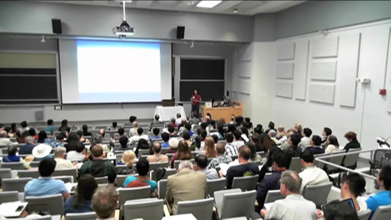
I was getting more and more nervous as I was realizing that I’m speaking among so many very prestigious people, which I’m not, and so many PhDs and Nobel laureates. But it’s about issues that I care about very deeply.
I’m an environmental scientist, an ecologist, an environmental engineer, and a mother. I take on the challenge—you know, this is such an important issue—to be able to engage us all in managing the world’s resources and water resources, and there are definitely different avenues in which we can do this. Because I think there exists an important convergence of science, technology, and community engagement, and I’m seeking the ways that we can address those issues collectively, and with all the tools that we are developing every day. So I want to figure out how this works.
A Project in Laos
I’m just going to share with you some of the work I did recently, last winter, in Laos. It was a project for the United Nations Development Program, and it was on climate change adaptation and water management in two different target communities in Laos. I have too many slides, so I’ll try not to dwell on them for too long, but in the comment section, if you’re interested in particular aspects, I’d be happy to share more about these with you at a later date.
One of the first things I did: I spent two months in Laos, but before that I spent two or three months developing a GIS approach to estimating water availability.
To give you context, Laos is in the Mekong River Basin in Southeast Asia. You can see the global regions of the world. The brown regions in the north are less than 25 centimeters of rainfall annually, and then as you approach the blue, there’s quite a bit more. But it’s seasonal: at different times, maybe too much water when you don’t need it, and too little water when you do. But in general, it’s a more humid region.
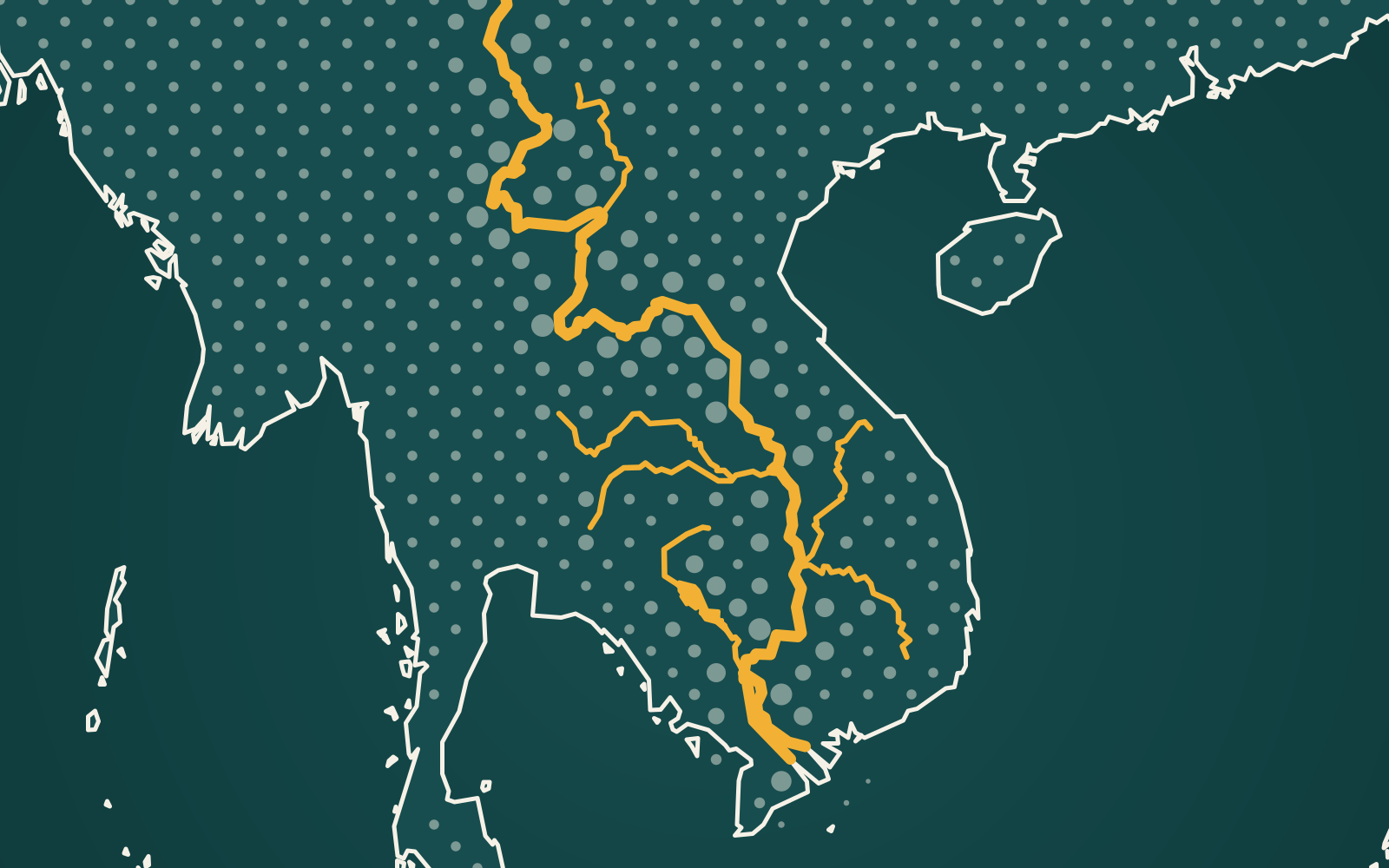
Laos occupies about 25% of the Mekong River Basin. This river basin starts in China: about 20 or 30% of the headwaters come from China, on the Tibetan Plateau. It goes through Laos and then the other countries you see there: Thailand, Cambodia, and Vietnam.
And so it’s a very poor area. It’s landlocked, it’s 85% agricultural, and there is food insecurity, because they need water at the right place to grow food. And 90% of the agriculture is rice production as well. So I was asked by the UN to come and help them address water management issues in these target areas, where they’re trying to adjust to climate change, and to have solutions for using water management to adapt to climate change.
So my first approach was—you can see the regions. This is [inaudible], where the Mekong River flows through, all along the border of Thailand. And there’s a big dam project there as well; there’s active construction on the dam. I went there, to the construction site. It’s the first non-Chinese Mekong River mainstem dam that is being built right now, and there are 15 more planned for the region. So this is another issue that I’m concerned about.
A Water Budget from Satellite Data
For this approach, I looked at these two areas here, Sayaburi and Savannakhet provinces. And I used satellite data on a GIS system; I downloaded them. There’s an elevation grid, at about 90 meters resolution. There’s precipitation, climate variables, temperature. And there are the different sources. You can freely get all this information. So if you’re working in a place in the world that doesn’t have data, you can actually go to the satellites and get the data you need to help make some of these decisions and help do some of the analysis.
So that’s what I did. And so when I showed up, they were very surprised that I had all this information already at my fingertips for the project.
I developed a watershed and stream network delineation, which involves a number of different steps in GIS, with hydrological and different spatial analyst tools. I don’t know how many of you are familiar with it, but I think GIS and GIS technology is becoming more and more important, and there are different ways that we can access information, process it, analyze it, and share it. So from this, I would also like to share the information through web-based tools as well, to engage the community, and also to inform them, and also to solicit their input.
Just last week, I was at the Esri conference, the GIS conference, and they’ve just developed a tool that, at a click of a button, instead of the laborious process I went through, you can actually develop your digital elevation map and create a stream network and a watershed—delineate the watershed—less laboriously than I did.
But I had catchments there, and basically I was able to estimate on a watershed scale where the different pour points are, and what type of contribution from water that comes from the sky, and how it would flow in the watershed, which I think should be the basic unit of analysis when we look at any water issues. So being able to say where your watershed is and how much water is coming to a certain point: you can actually just select a point, and it’ll delineate the watershed above it. This one as well identifies an area in my study area, which represents 203,000 grid cells, which is 1,600 [square] kilometers. And you can do this all from information that you’ve collected from the satellite.
So in order to see how much water we have at a certain point, I use a very simple analysis: I use precipitation minus evapotranspiration. Evapotranspiration is the amount of water that’s taken up by plants and then put into the atmosphere. There’s an equation that uses just temperature and solar radiation, and on a monthly basis, you can get the annual evapotranspiration that’s estimated for a particular region in the world. So my assumption is then that the water that’s available is precipitation minus evapotranspiration. And I have to neglect the losses, or any outflows or drainage to groundwater, or withdrawals, because I don’t have any of this information. So this would be an upper bound for what water is available.
And then I looked on a grid-by-grid, one-kilometer resolution scale, for actually all of Southeast Asia: I developed a model for all of Southeast Asia. And actually, we could do it anywhere in the world, because there is one-kilometer grid resolution for the entire planet. There are some issues of resolution: the data that comes in a one-kilometer grid, and how it fits into the area that you’re looking at. But I used a raster calculator, which is a GIS tool, and I could estimate, for July, the seventh month, how much rainfall would be at any given point.
So this is spatial analysis. And I developed a model that would take each of the grid cells that I cared about, and each of the months that I cared about, and each of the parameters and the equations and the data that I need. And in the end, I would get a mask for evapotranspiration. I would get one for every one-square-kilometer pixel, then, for all of Laos. This is Laos, and it’s by this equation down here. And then I predicted water availability by each month. And this is the information I’m using for the next [inaudible] of my project.
This is all of Laos, and these are the areas that have a lot of rainfall, at least in August, and they’re a little bit less. And it comes with precipitation minus evapotranspiration.
I wanted to look at how much water is available per agricultural output, but I didn’t have data on agriculture. So I used population as a proxy for how much water is available per person in a given area. So this became my water supply index. And I have a water per capita analysis there, where you can see which areas are more stressed. The darker areas would be more stressed, and the bluer areas are less stressed.
[Someone in the audience asks, “What’s the unit?”]
It’s water per capita. It would be millimeters per person, annual. And actually, this is relative; you can just see it. I wanted to use the specific numbers for water harvesting projects in the region.
These are the regions that the UN asked me to look at. It’s in Sayaburi and Savannakhet. So the annual average precipitation is 1,600 millimeters in both places, but it’s temporally and spatially divergent. So it’s whether that can be used.
I compared it to local rainfall gauges, and I thought it was pretty good. It’s like within 10% of the annual, if you use the satellite data and if you use the actual rain gauges. So when they exist, the numbers turn up well enough to actually do projects. So it’s 10% for Sayaburi, maybe up to 20% off, especially in the rainy season, at maximum precipitation, in Savannakhet.
So, the conclusion of this part—and I have like three sections that I want to share with you, and I’m sorry if it goes too fast—but I think that satellite technology, GIS, and spatial analysis is an important tool to address any of the resource problems that we have.
Catching the Rain
So the next section of this project I did in Laos was water harvesting, and I looked at different water harvesting opportunities. So it’s the water that falls from the sky, and collecting that.
I wanted to give you a slight review: globally, this is a water planet that we live on. But actually, 97% of that is in the oceans, which is salty, and two and a half percent is fresh water. But of that, 87% is frozen—ice and snow; you can’t really use it. And 12% of it is groundwater, and the groundwater resource, you need energy to pump it out. So the actual fresh surface water that we use is only 0.8% of the 2.4% of the fresh water. And of that fresh water, there’s only about 45%, or half of it, in lakes and reservoirs. 23%, or a quarter of it, is soil moisture. A quarter of it is in animals and plants. 5% of it’s in the atmosphere. So when we’re talking about rainwater, that’s what we’re collecting and using as a rainwater harvesting system. One and a half percent is in the wetlands, and 0.6% is in the rivers and streams that we dam and divert and use. So actually, only 0.01% of the world’s fresh water is in lakes, rivers, and wetlands, and that’s what we’re trying to use. Of course, we don’t know how to. We’re learning every day how better to use it, and not to abuse it, and not to pollute it.
So this is residence time: the water cycles through. I don’t want to really dwell on this, but basically, in the hydrologic cycle, one drop of water stays on our planet and cycles in different forms for eternity. So what this project is doing is trying to intercept some of the rain that’s coming from the sky, and capturing it and using it before it runs into the lakes or groundwater or the ocean.
Sustainable water harvesting, for me, is that it can be applied in many different situations; that it’s inexpensive; that it can be easily installed and maintained by the local people; and that the people want it, that it’s desired by the population. So that would be sustainable, in that we can use it and that we want to use it.
There are three types that I talk about. One is a rainwater harvesting system from a rooftop catchment, the other is from a ground catchment, and the other is from a rock river and a weir. I outlined some of the possibilities; there are a lot of people working on different types of systems.
Maybe I’ll just flip through these a little bit quickly, but basically you have a catchment system. You have the roof. You have to be concerned about what type of material the roof is made of. So if there were contaminants or not, you would know whether you’d want to store the water underground or above ground; and what type of containment structure—large or small, or fitting to which population—what type you would use; what type of local materials are available; who can get involved with building it; how much does it cost. And you can compare the different types of materials and what’s available.
These are cisterns of a thousand liters that are used in Thailand. Between 1978 and—I think the Thai government instituted a 20-year—in 20 years, they went from zero to 20,000 of these tanks, these urns, that were available. They’re called ongs. And so since Laos is right next to Thailand, we thought this would be a possibility, and easy to construct in the field and have locally.
I looked at different types and sizes of tanks and the costs of them; what type of collection system you would need; how you would need to filter and take out any types of pollutants or leaves—screens. And then you have to calculate also how much can you collect. So, in theory, you can collect whatever annual rainfall falls on your roof, and maybe you lose 30% of it: some of it will evaporate, it’ll flow over, it’ll drain, and you have to do a first flush so you don’t get dirty water into your collection system.
So at a school in Laos, I estimated and costed out a water harvesting system, to be used as a model for the other areas in Laos. There were 72 students [inaudible] teachers there. The roof area was 42 by 8, and I calculated out what the precipitation was there and how much we could collect. It’s very simple, and you can do it too: you try to estimate and calculate out your rainwater harvesting system. You can take your calculator; try it.
So land surface catchment is another type that we looked at, as rock weirs, sometimes intercepting the groundwater. And one of the things I was trying to avoid, though, is too much diversion of the scarce river resources that we have.
These are some of the ground catchment systems: they may be wetlands, or they just may be ponds that were built in Laos. These are all photos that I took. They’re used for different things: for livestock—I made recommendations for livestock—for aquaculture. And these here are floating ponds, floating fish culture. So in areas that flood a lot, you could grow fish without them escaping. So we made different recommendations, like for this area here that floods up to a meter, and the schools all shut down, and there’s very little agriculture that can occur because of it.
Sometimes, in different places in the world that are more arid, you would want to be able to capture as much water to recharge your groundwater resources. This is a picture of an area in Ethiopia.
In the Field
Let’s see, I had another one. But these are GIS maps of the area that I was in, and all the points that we went to. And I did a GPS training for the local counterparts, because I think that spatial analysis could be a key to solving some of their problems, or at least looking at them.
They have irrigation systems as well. This is a beautiful canal that was built with the support of a nonprofit, and they want to expand the production areas related to it.
The other area is in Savannakhet, in the south. The area we looked at was in a river floodplain, and it floods every year. And so they were looking to us for solutions for how to manage their water, since there’s too much of it during the rainy season, and still not enough during the dry.
One of the solutions they had in this area was to build this rock weir—so a dam catchment—that actually created a lot of erosion along the banks, and the gabions that they have. It’s this idea that we can engineer whatever we want, to provide whatever we want at a certain time. And it’s not always true. You can see that this reservoir right now is useless; it doesn’t have any water. So no one calculated out how much was available at that time, or even coordinated with other agencies to see how much would be diverted from the river for other purposes. So that’s why I think spatial analysis and coordination among agencies and people is important.
This is one thing that they do have in adapting to the circumstances there of not enough water: they start to grow vegetables instead of rice. Rice takes five times as much water, and vegetables take a little—you can see vegetables, beans—and they can earn a profit. And this is charcoal. So there are different things that people can do: small farms, vegetables, or other sorts of technologies; maybe ecotourism; maybe something other than rice.
So I made recommendations for each of the areas, and generally. And then I also talked about what climate change adaptation is, and what kinds of things we could promote, so we can be better prepared for uncertainties in water availability. So what I say is that water harvesting can be sustainable if it is adapted to the local conditions and the local community is involved.
Know the Issues, Engage the People, Envision Change
So this now is the last part, and I’m going to be a little bit more esoteric. It’s not about the water harvesting project or the project I did in the UN, but in general: everything is in a river. The river runs through it. We are in a watershed. We all belong to a watershed, and we all should be concerned about the things that happen within our watershed.
These are the top 10 largest rivers, and the Mekong River, you can see, is the eighth longest. The Mississippi and the Yangtze are the sixth and seventh, or the [inaudible] is the fourth. There’s a lot of water in the rivers of the world, even though it’s just 0.01%, and it’s an important resource for us.
I spent some time at Lake Baikal in the nineties, and it has a quarter of the world’s fresh water in this one lake. So it’s a critical resource. I’d say that this is one place where transboundary protection, and engaging with people, could really help with better solutions to maintaining the environment and supporting people.
So my theme, that I will end with, is: for every watershed and every issue, just know what’s involved. Know the issues; collect the information, and see the site. Engage the people: go there, talk to people, help others learn more about the community and agencies and the residents and the engineers, to engage the people. And then envision change.
The Tumen River area is another area I worked on, in the nineties, where the United Nations first started a development program. It’s very complex. It involves five countries, and extracting the resources from Siberia and Mongolia and Russia, and bringing it out to the Tumen River, dredging the mouth of the river. It involves China, Russia, North Korea, South Korea, and Mongolia: a huge issue. So I worked on this from an NGO perspective, involving local environmentalists and local people.
So for the Tumen River area, it’s the same. Know the issues: know where they’re extracting timber, what wildlife is there. That’s the bridge that connects Russia and North Korea, standing on the Chinese side. There are Siberian tigers in that area. Know the issues; engage the people—see them, talk to them, ask what they want, get them involved—and envision change.
The work that we did in the nineties did end up resulting in some changes in the UN policies, in trying to involve local people. They created a fund, the Global Environment Facility, to address environmental issues that happen with World Bank projects. And a lot of different other people—they make new movies, they do [inaudible], or they produce literature or books.
And the last one was black-necked cranes in Yunnan Province. It’s another area that I worked; I spent six months there. So, know the issues again; engage the people—teach, talk to, educate—and then envision change, so we can have a sustainable future for people and for the ecology.
Thank you.
Transcribed from the video and lightly edited.